DATAINFORMATION
At Universalprosjekt Geosystemer, we use a selection of multi-advanced software to ensure the best results for our customers. Below is an overview of what our software offers you. We adapt our data delivery specialized to your exact needs to give you maximum efficiency of your project.
Our software programs give you:
Flexible field solutions: Manage comprehensive tasks in the field, from measurement to calculations.
Seamless integration: The system effectively connects field and office solutions for optimal workflow.
Sitevision with AR technology: Technology with accuracy precision of visual displays of constructions.
BIM and CAD support: Handles both BIM and CAD, ensuring precise and efficient project deliveries.
AI optimization & export formats: The AI technology handles water surfaces automatically and calculates the correct format.
Improved processing efficiency: Accurate measurement results without image distortion and deformation.
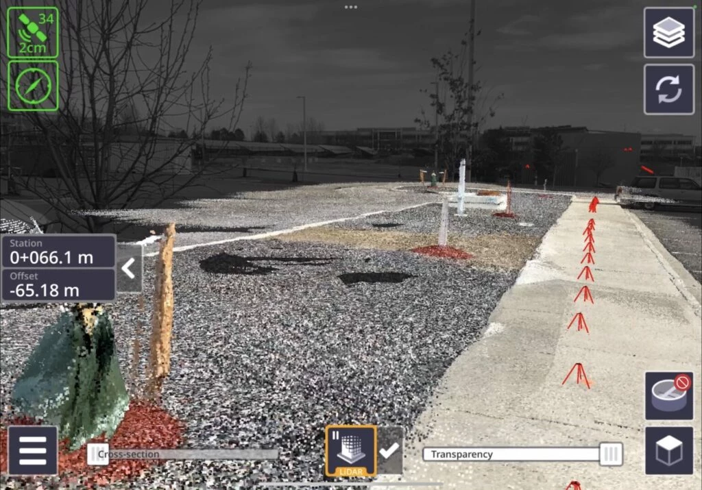
Other: Point cloud, preparation for machine control, data for machines & sticks, point cloud, visible light data, ground point extraction, DEM generation
FIND YOUR NEEDS
SOFTWARE/SYSTEMS
TRIMBLE
TBC
TRIMBLE
SITEVISION
TRIMBLE
REAL WORKS
DJI
MODIFY

DJI
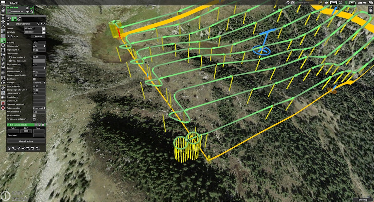
TERRA
UGCS
SPH

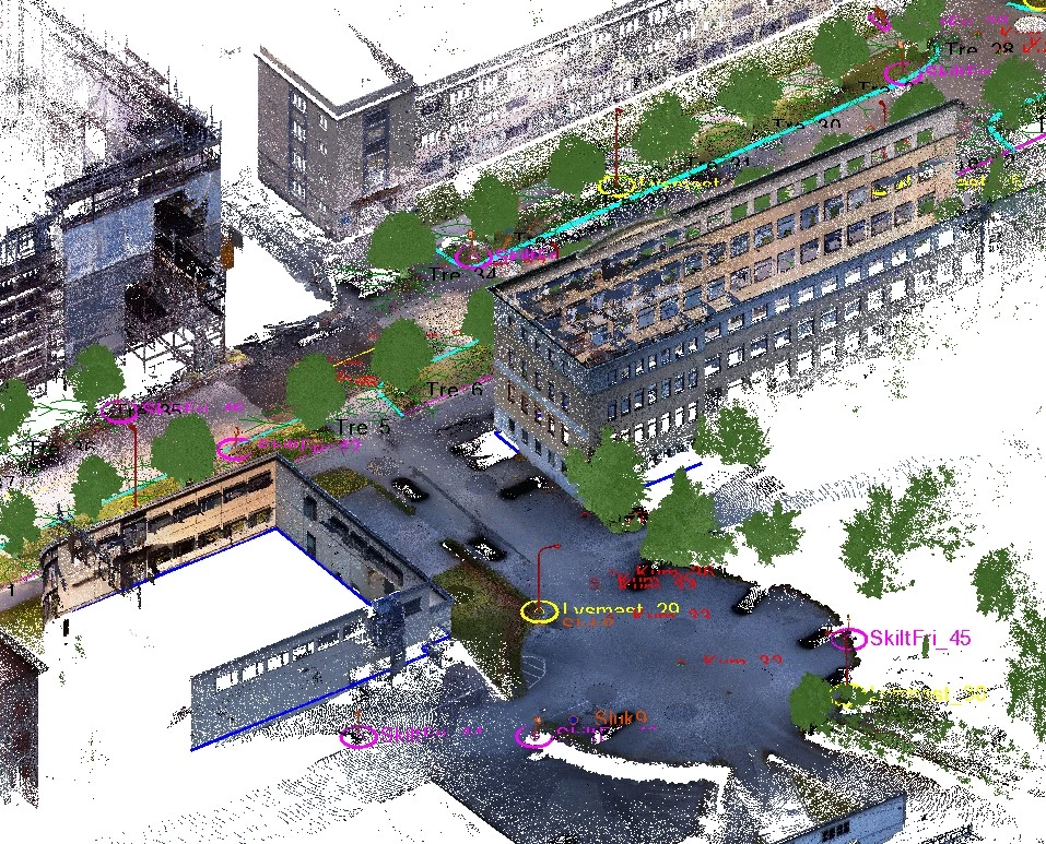
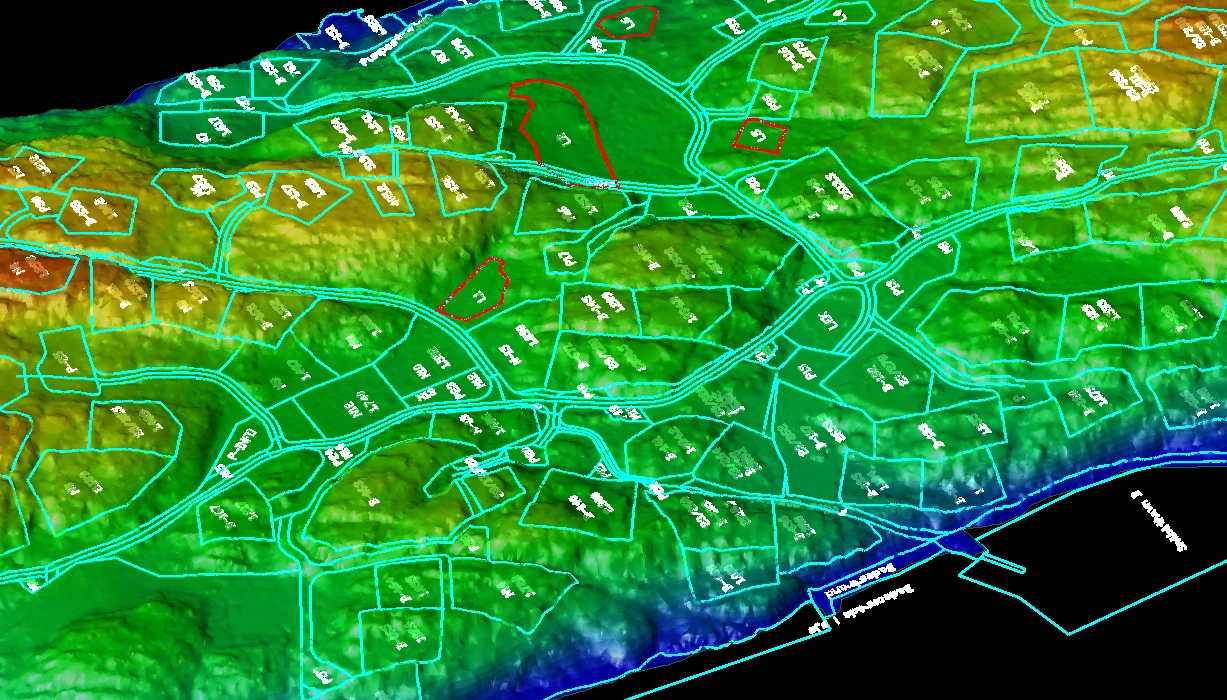
Using a terrain model generated from Lidar data collected by drone, we have integrated the zoning plan directly into a detailed 3D model that adapts to existing terrain conditions. This accurate data representation makes it possible to visualize the project in the present, while at the same time we can simulate historical conditions. A comparison between e.g. the water level from 6,000 years ago to today will provide a quality-assured understanding of possible conflicts with landscape development, archaeological discoveries, climate development and more. This will provide the opportunity for necessary adjustments early in the project phase, which can provide major cost savings for the customer later on.
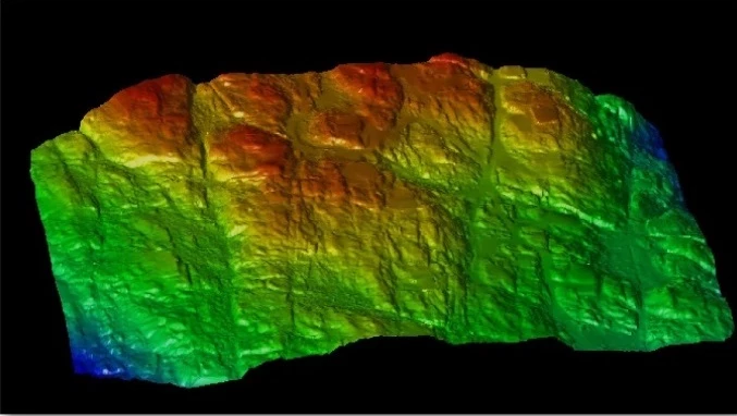
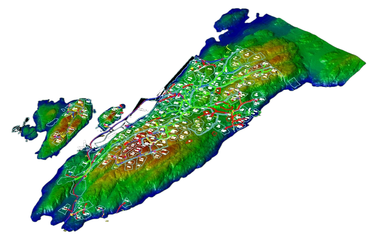
After collection, the data is carefully processed to construct a digital terrain model, especially adapted to mountain coordination. This model provides a precise representation of the terrain and is used as a solid basis for further work and planning. Through advanced software, we can analyze and visualize geological and topographical conditions, which is essential for optimal planning and implementation of projects in mountainous areas. The digital terrain model facilitates the identification of potential challenges and opportunities in the project, and contributes to increased efficiency and safety in the decision-making process.
CONTACT US